Hemis to Tso Moriri
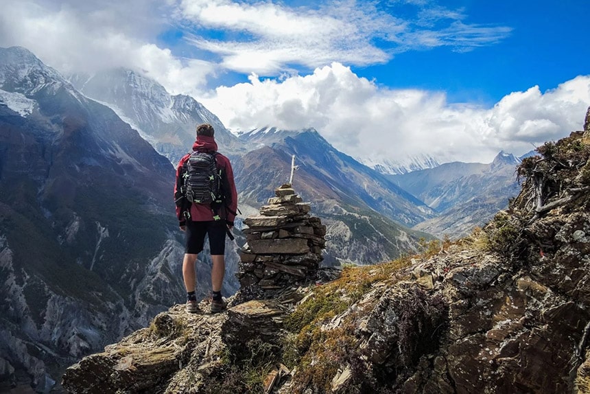
Annapurna circuit trek
Trek duration: 13 days (short version)
Trek difficulty: Moderate
Max altitude: 55416m at Thorong La Pass
Accommodation: Teahouses
Best time: March to May and October to December
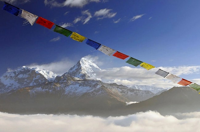
The Annapurna Circuit is one of Nepal’s most scenic long-distance trekking routes. Encircling the Annapurna Massif, the trail passes through lush valleys, dry highlands, subtropical forests and alpine terrain, offering ever-changing landscapes and cultures. From lowland rice fields to snow-covered passes, this trek is as varied as it is rewarding.
Unlike treks in Ladakh that often involve camping, the Annapurna Circuit trek is lined with teahouses, making it logistically easier for those who prefer to trek with lighter packs. The highlight of the trek is the crossing of Thorong La (5416m), a high mountain pass that connects the Manang and Mustang regions. Along the way, trekkers encounter Gurung, Manangi and Thakali villages, ancient monasteries and the sacred pilgrimage site of Muktinath.
The Annapurna Circuit is suitable for trekkers with a good level of fitness and some prior experience with high-altitude trekking. In terms of duration and challenge, it is comparable to the Markha Valley trek or the Rumtse to Tso Moriri trek in Ladakh. While road construction has shortened the traditional route, the trek still offers some of the best views in the Himalayas.
Itinerary
Day 1: Kathmandu (1400m) - Besisahar (760m) - Dharapani (1960m)
Time: 9-10 hrs (drive)
Distance: 230 km by road
The journey begins with a long drive from Kathmandu to Besisahar, continuing up a rough mountain road to Dharapani. The village sits in a narrow forested valley where the Marsyangdi River rushes through steep cliffs and waterfalls.
Day 2: Dharapani (1960m) - Chame (2710m)
Time: 5-6 hrs
Distance: 15 km
The trail climbs steadily through pine and fir forests, passing mani walls and chortens along the way. Chame is the district headquarters of Manang and offers views of Lamjung Himal and Annapurna II.
Day 3: Chame (2710m) - Pisang (3300m)
Time: 5-6 hrs
Distance: 13 km
The path leads through a deep gorge and past dramatic rock formations. After crossing several suspension bridges, trekkers arrive in Pisang, a village set against the backdrop of Annapurna II and the surrounding peaks.
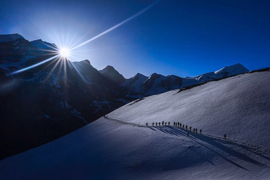
Day 4: Pisang (3300m) - Manang (3540m)
Time: 6-7 hrs
Distance: 16 km
Today’s walk offers two route options. The upper trail through Ghyaru and Ngawal is more scenic, with panoramic views of the Annapurna range, but also more strenuous. Both routes meet in the village of Braga, just before Manang.
Day 5: Acclimatization day in Manang
A rest day to help adjust to the altitude. Trekkers can explore the village or hike up to Gangapurna Lake and a viewpoint above Manang for views of the glacier and surrounding peaks. Staying active supports the acclimatization process.
Day 6: Manang (3540m) - Yak Kharka (4050m)
Time: 4-5 hrs
Distance: 10 km
The landscape becomes more barren as the trail ascends through juniper bushes and yak pastures. After passing several herders’ huts, the path reaches Yak Kharka, a small settlement with wide views across the valley.
Day 7: Yak Kharka (4050m) - Thorong Phedi (4450m)
Time: 3-4 hrs
Distance: 7 km
A short but important day to continue the acclimatization process. The trail climbs gradually to Thorong Phedi, the last stop before the pass. Some trekkers may continue to High Camp (4850m) to shorten the next day’s climb.
Day 8: Thorong Phedi (4450m) - Thorong La (5416m) - Muktinath (3800m)
Time: 8-9 hrs
Distance: 15 km
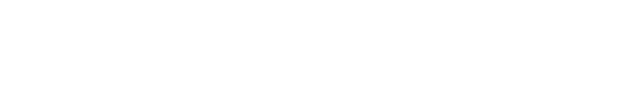
This is the most challenging day of the trek. A pre-dawn start leads to the top of Thorong La, marked with prayer flags and a signboard. After enjoying the views, trekkers descend steeply to Muktinath, a sacred site for both Hindus and Buddhists.
Day 9: Muktinath (3800m) - Jomsom (2720m)
Time: 6-7 hrs
Distance: 18 km
The path descends through the dry, windswept landscape of Lower Mustang. Trekkers pass through the village of Kagbeni before reaching Jomsom, a town located on the banks of the Kali Gandaki River.
Day 10: Jomsom (2720m) - Tatopani (1190m)
Time: 5-6 hrs (drive)
Distance: 67 km by road
From Jomsom, a jeep ride descends along the deepest gorge in the world. Tatopani is famous for its natural hot springs, where trekkers can relax after several days at altitude.
Day 11: Tatopani (1190m) - Ghorepani (2860m)
Time: 7-8 hrs
Distance: 17 km
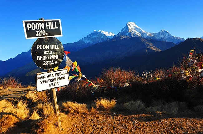
The trail climbs steeply through terraced farmland and forested ridges. The village of Ghorepani is perched just below the famous viewpoint of Poon Hill.
Day 12: Ghorepani (2860m) - Poon Hill (3210m) - Nayapul (1070m) - Pokhara (820m)
Time: 8-9 hrs
Distance: 19 km walking + 2 hrs drive
An early morning hike leads to Poon Hill for sunrise views of Dhaulagiri, Annapurna and Machapuchare. After breakfast, the trail descends through rhododendron forests to Nayapul, where the trek ends with a drive to Pokhara.
Day 13: Pokhara - Kathmandu
Time: 6-7 hrs (drive) or 30 mins (flight)
Major Highlights
| • | Crossing Thorong La Pass at 5416m |
| • | Diverse landscapes from subtropical valleys to high alpine terrain |
| • | Traditional villages and Tibetan-influenced cultures |
| • | Views of Annapurna I, II, III, IV, Gangapurna and Dhaulagiri |
| • | Sacred site of Muktinath |
| • | Sunrise from Poon Hill |
| • | Teahouse trekking with hot meals and simple accommodation |
Alternative Routes
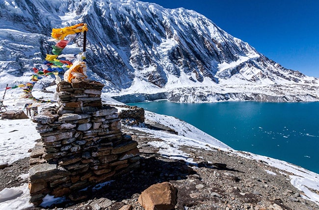
| • | Tilicho Lake: A side trip from Manang to one of the highest lakes in the world (4919m) |
| • | Annapurna Base Camp: A separate trek that leads into the heart of the Annapurna Sanctuary |